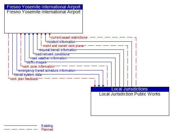
Interface: Fresno Yosemite International Airport - Local Jurisdiction Public Works
Architecture Flow Definitions
current asset restrictions (Planned)
Restrictions levied on transportation asset usage based on infrastructure design, surveys, tests, or analyses. This includes standard facility design height, width, and weight restrictions, special restrictions such as spring weight restrictions, and temporary facility restrictions that are imposed during maintenance and construction.
emergency transit schedule information (Existing)
Information on transit schedule and service changes that adapt the service to better meet needs of responders and the general public in an emergency situation, including special service schedules supporting evacuation.
incident information (Existing)
Notification of existence of incident and expected severity, location, time and nature of incident. As additional information is gathered and the incident evolves, updated incident information is provided. Incidents include any event that impacts transportation system operation ranging from routine incidents (e.g., disabled vehicle at the side of the road) through large-scale natural or human-caused disasters that involve loss of life, injuries, extensive property damage, and multi-jurisdictional response. This also includes special events, closures, and other planned events that may impact the transportation system.
maint and constr work plans (Planned) Applicable ITS Standards
Future construction and maintenance work schedules and activities including anticipated closures with anticipated impact to the roadway, alternate routes, anticipated delays, closure times, and durations.
request transit information (Existing)
Request for transit service information and current transit status.
road network conditions (Existing)
Current and forecasted traffic information, road and weather conditions, and other road network status. Either raw data, processed data, or some combination of both may be provided by this architecture flow. Information on diversions and alternate routes, closures, and special traffic restrictions (lane/shoulder use, weight restrictions, width restrictions, HOV requirements) in effect is included along with a definition of the links, nodes, and routes that make up the road network.
road weather information (Existing)
Road conditions and weather information that are made available by road maintenance operations to other transportation system operators.
traffic images (Existing)
High fidelity, real-time traffic images suitable for surveillance monitoring by the operator or for use in machine vision applications.
transit system data (Existing)
Current transit system operations information indicating current transit routes, the level of service on each route, and the progress of individual vehicles along their routes for use in forecasting demand and estimating current transportation network performance.
work plan feedback (Planned)
Comments and suggested changes to proposed construction and maintenance work schedules and activities. This information influences work plan schedules so that they minimize impact to other system operations and the overall transportation system.
work zone information (Planned)
Summary of maintenance and construction work zone activities affecting the road network including the nature of the maintenance or construction activity, location, impact to the roadway, expected time(s) and duration of impact, anticipated delays, alternate routes, and suggested speed limits. This information may be augmented with images that provide a visual indication of current work zone status and traffic impacts.