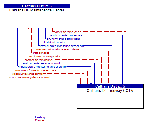
Interface: Caltrans D6 Maintenance Center - Caltrans D6 Freeway CCTV
Architecture Flow Definitions
barrier system control (Planned) Applicable ITS Standards
Information used to configure and control barrier systems that are represented by gates, barriers and other automated or remotely controlled systems used to manage entry to roadways.
barrier system status (Planned) Applicable ITS Standards
Current operating status of barrier systems. Barrier systems represent gates, barriers and other automated or remotely controlled systems used to manage entry to roadways. Status of the systems includes operating condition and current operational state.
environmental probe data (Existing)
Data from vehicle safety and convenience systems that can be used to estimate environmental conditions, including measured air temperature, exterior light status, wiper status, sun sensor status, rain sensor status, traction control status, anti-lock brake status, and other collected vehicle system status and sensor information. The collected data is reported along with the location, heading, and time that the data was collected. Both current data and snapshots of recent events (e.g., traction control or anti-lock brake system activations) may be reported.
environmental sensor data (Existing) Applicable ITS Standards
Current road conditions (e.g., surface temperature, subsurface temperature, moisture, icing, treatment status) and surface weather conditions (e.g., air temperature, wind speed, precipitation, visibility) as measured and reported by fixed and/or mobile environmental sensors. Operational status of the sensors is also included.
environmental sensors control (Existing) Applicable ITS Standards
Data used to configure and control environmental sensors.
field device status (Existing) Applicable ITS Standards
Reports from field equipment (sensors, signals, signs, controllers, etc.) which indicate current operational status.
infrastructure monitoring sensor control (Existing) Applicable ITS Standards
Data used to configure and control infrastructure monitoring sensors.
infrastructure monitoring sensor data (Existing) Applicable ITS Standards
Data read from infrastructure-based sensors that monitor the condition or integrity of transportation infrastructure including bridges, tunnels, interchanges, pavement, culverts, signs, transit rail or guideway, and other roadway infrastructure. Includes sensor data and the operational status of the sensors.
roadway information system data (Planned) Applicable ITS Standards
Information used to initialize, configure, and control roadside systems that provide driver information (e.g., dynamic message signs, highway advisory radio, beacon systems). This flow can provide message content and delivery attributes, local message store maintenance requests, control mode commands, status queries, and all other commands and associated parameters that support remote management of these systems.
roadway information system status (Planned) Applicable ITS Standards
Current operating status of dynamic message signs, highway advisory radios, beacon systems, or other configurable field equipment that provides dynamic information to the driver.
traffic images (Planned) Applicable ITS Standards
High fidelity, real-time traffic images suitable for surveillance monitoring by the operator or for use in machine vision applications.
video surveillance control (Planned) Applicable ITS Standards
Information used to configure and control video surveillance systems.
work zone warning device control (Planned) Applicable ITS Standards
Data used to configure and control work zone safety monitoring and warning devices.
work zone warning status (Planned) Applicable ITS Standards
Status of a work zone safety monitoring and warning devices. This flow documents system activations and includes additional supporting information (e.g., an image) that allows verification of the alarm.